
Disclaimer: This site is not affiliated with the National Hurricane Center, Hurricane Hunters, Storm Prediction Center, or National Weather Service. ALL forecasts herein are the result of my analysis, and I am solely responsible for the content. As ALWAYS, follow the National Hurricane Center, National Weather Service, and your local Emergency Management officials for emergency decisions. In addition, this is strictly a FORECAST OFFICE. I CANNOT make decisions regarding travel plans, etc. My purpose, is to provide you the information, based solely on information I analyze, and the accuracy of the information at hand of the time of analysis, so you may make informed decisions.
(T. F. “Storm” Walsh)
For those who have donated to my site, your help has been greatly appreciated. If you are not aware, donations to my site help pay for subscriptions to sites I use as well as software updates, which provide all the models and information used in my forecasts. To donate, please click the DONATE button to the right side of the page, or on the graphic of the dog. Any help you provide is immensely appreciated!
DONATIONS NEEDED AND APPRECIATED


I will reiterate, my forecasts are based on the available information at the time of analysis, and are only as accurate as the information analyzed and the solutions provided.
Good day everyone!
In regard to today’s severe weather risk, due to analysis of the upcoming coastal storm for the eastern seaboard, and a 2:00 p.m. appointment, I am not able to go in depth and breakdown the severe weather for today. The SPC maps I will be posting, will be linked to the text outlooks. I do intend to update sometime Saturday for the risk on Sunday, and provide another forecast on Monday, for Monday’s threat.
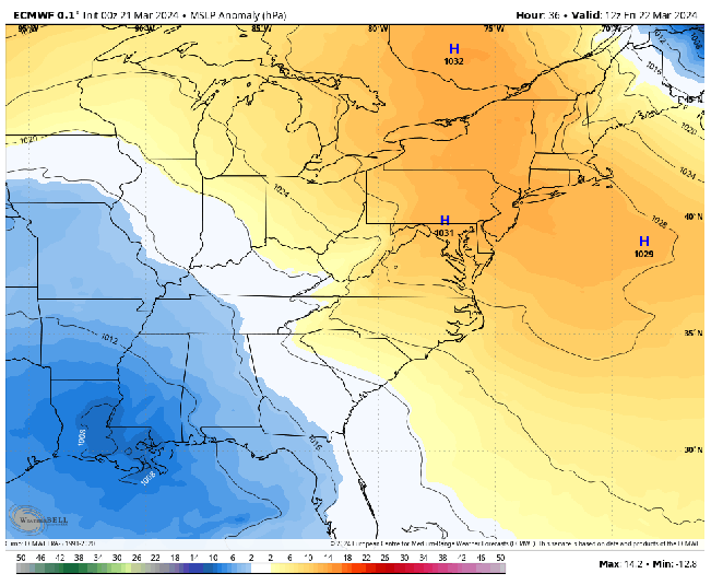
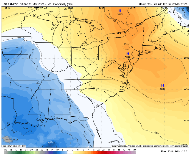
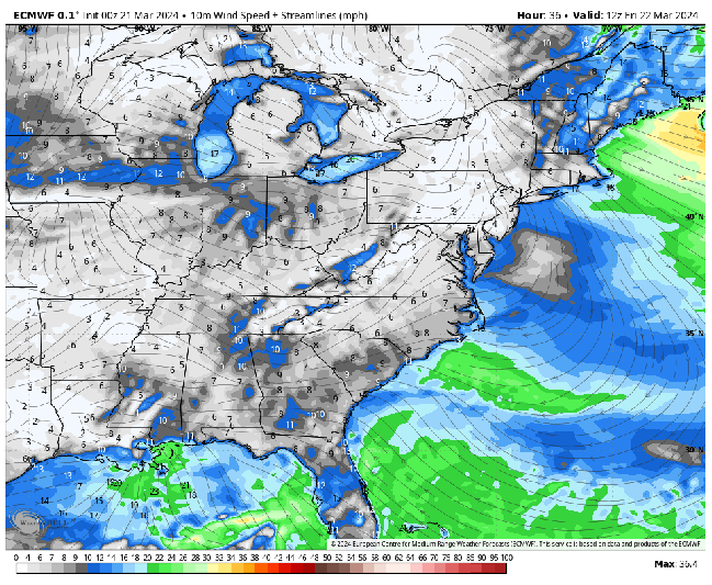
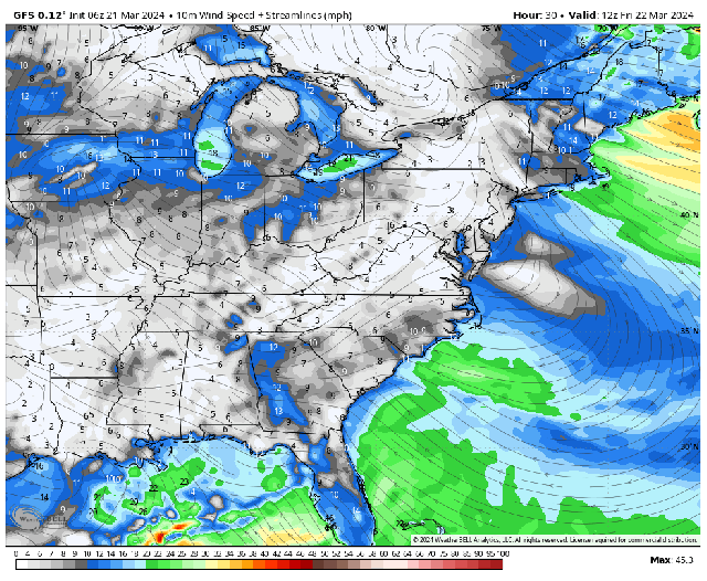
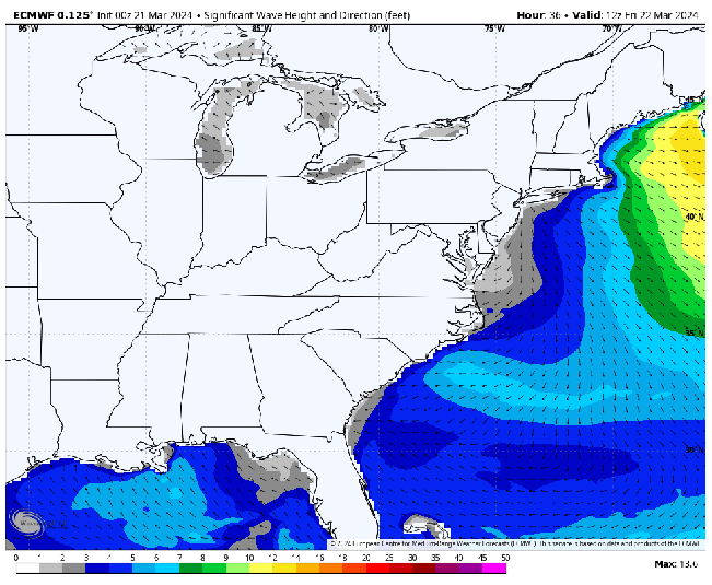
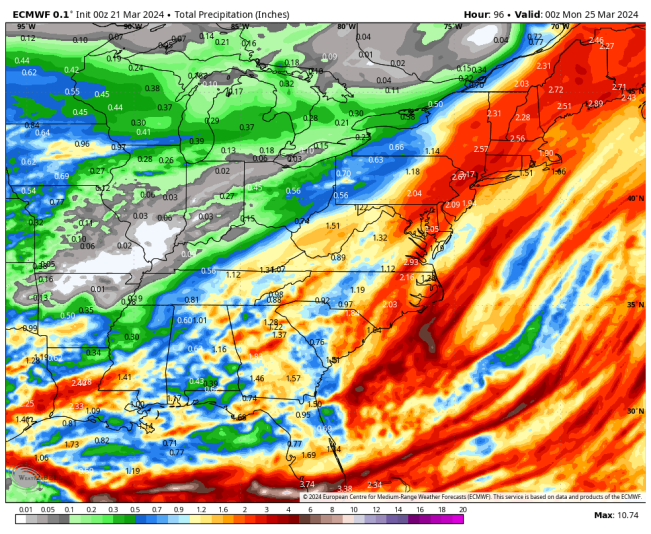
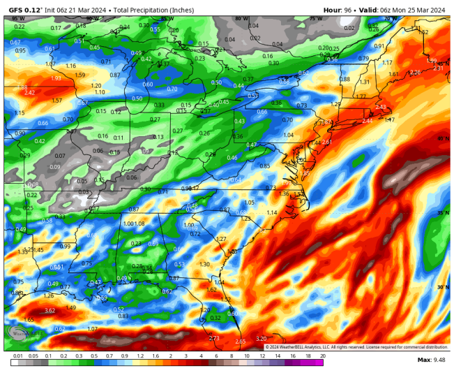
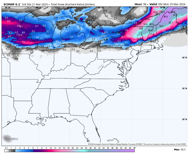
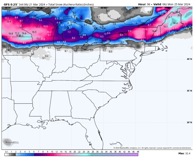
Based on my analysis of the ECMWF, and GFS models, an area of lower pressure is forecast to begin developing over Gulf coast area on the coast by late tomorrow morning, increasing in size, and moving east by ENE over the Florida peninsula, then strengthening into a coastal storm / Miller “type A” Nor’easter off the eastern seaboard becoming elongated then splitting. Surface winds could reach 30 mph along the coast over portions of the eastern seaboard, and minimal to moderate tropical storm force well off shore. The system could produce 2.00+ inches of rain over portions of the Mid Atlantic, NE, and New England regions. along with snow over portions of the NE and Great Lakes regions. Wave heights could reach 10 ft. near the immediate coast along the eastern seaboard, and up to 18 ft. well offshore. This, along with the onshore flow and rain, could produce coastal flooding in some areas along the coast. Small craft should remain in port, and residents should remain away from beaches until the system has passed.
ECMWF AND GFS MSLP ANOMALY FORECAST
ECMWF AND GFS SURFACE WIND FORECAST
ECMWF FORECAST SIGNIFICANT WAVE HEIGHTS
ECMWF AND GFS 96 HOUR FORECAST PRECIPITATION TOTALS
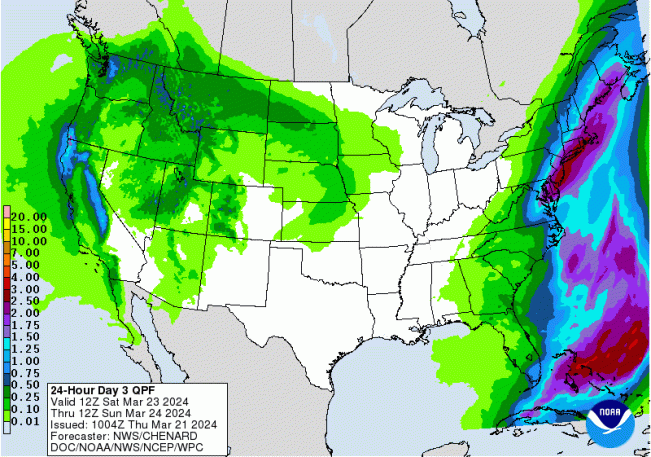
WPC 3 DAY RAINFALL FORECAST
ECMWF AND GFS FORECAST SNOWFALL TOTALS
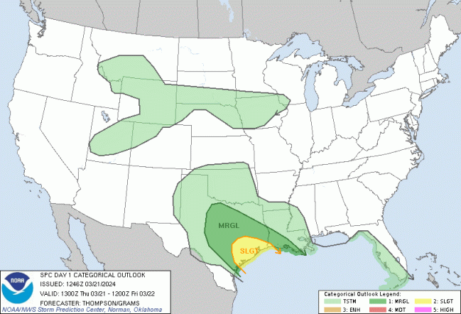
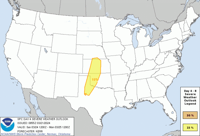
The following are the Storm Prediction Center maps for today, Sun., and Mon., and are linked to their respective reports.
DAY 1
DAY 4
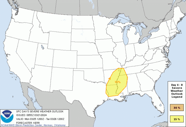
 DAY 5
DAY 5
The following NWS Watch / Warning map will provide local NWS information for your area. Click the image, then once it refreshes, click on your area of interest to view any special weather statements, hazards or advisories for your area.
NWS WATCH / WARNING DISPLAY (LINKED…CLICK MAP, THEN YOUR AREA)

NWS DOPPLER RADAR LOOP (LINKED, CLICK RADAR MAP)

RAP RADAR (CLICK IMAGE THEN GO TO LOOP DURATION AND PICK LENGTH OF LOOP, THEN CLICK RADAR SITE)
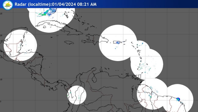
CARIBBEAN RADAR (CLICK IMAGE)
You may direct any questions by contacting me personally, ANYTIME, at: twalsh22000@yahoo.com
Have a blessed day!
T. F. “STORM” WALSH III
GMCS, USCG (ret)
METEOROLOGIST / HURRICANE SPECIALIST /SEVERE WEATHER SPECIALIST


