URGENT UPDATE: WIDEST DISSEMINATION REQUESTED:
This Severe Weather Event has evolved into a PDS. The Storm Prediction Center has issued watch number TW695 to a PDS TORNADO WATCH!
URGENT – IMMEDIATE BROADCAST REQUESTED
TORNADO WATCH NUMBER 695
NWS STORM PREDICTION CENTER NORMAN OK
1255 PM CST TUE DEC 25 2012
THE NWS STORM PREDICTION CENTER HAS ISSUED A
TORNADO WATCH FOR PORTIONS OF SOUTHWESTERN AND WEST-CENTRAL ALABAMA…EASTERN AND SOUTHEASTERN LOUISIANA…CENTRAL AND SOUTHERN MISSISSIPPI COASTAL WATERS… EFFECTIVE THIS TUESDAY AFTERNOON AND EVENING FROM 1255 PM UNTIL 800 PM CST.
…THIS IS A PARTICULARLY DANGEROUS SITUATION
…DESTRUCTIVE TORNADOES…LARGE HAIL TO 1.5 INCHES IN DIAMETER…THUNDERSTORM WIND GUSTS TO 75 MPH…AND DANGEROUS LIGHTNING ARE POSSIBLE IN THESE AREAS.
THE TORNADO WATCH AREA IS APPROXIMATELY ALONG AND 125 STATUTE MILES EAST AND WEST OF A LINE FROM 25 MILES SOUTHWEST OF BOOTHVILLE LOUISIANA TO 40 MILES NORTHEAST OF JACKSON MISSISSIPPI. FOR A COMPLETE DEPICTION OF THE WATCH SEE THE ASSOCIATED WATCH OUTLINE UPDATE (WOUS64 KWNS WOU5).
REMEMBER…A TORNADO WATCH MEANS CONDITIONS ARE FAVORABLE FOR TORNADOES AND SEVERE THUNDERSTORMS IN AND CLOSE TO THE WATCH AREA. PERSONS IN THESE AREAS SHOULD BE ON THE LOOKOUT FOR THREATENING WEATHER CONDITIONS AND LISTEN FOR LATER STATEMENTS AND POSSIBLE WARNINGS.
OTHER WATCH INFORMATION…THIS TORNADO WATCH REPLACES TORNADO WATCH NUMBER 692. WATCH NUMBER 692 WILL NOT BE IN EFFECT AFTER 1255 PM CST. CONTINUE…WW 693…WW 694
…DISCUSSION…WARM SECTOR SPREADING INLAND ACROSS WW AREA WILL BECOME INCREASINGLY JUXTAPOSED WITH STRENGTHENING DEEP SHEAR AND ENLARGED LOW-LEVEL HODOGRAPHS. MCS MOVING EWD INTO THIS REGIME WILL ENCOUNTER MLCAPE 500-1500 J/KG…WITH EFFECTIVE SRH MAXIMIZED NEAR WARM FRONT AT 400-600 J/KG. ANY RELATIVELY SUSTAINED/DISCRETE SUPERCELLS WILL OFFER RISK OF LONG-TRACKED/DAMAGING TORNADOES.
DAMAGING GUSTS AND OCNL TORNADOES ARE ALSO LIKELY FROM QLCS/LEW/BOW STRUCTURES.
AVIATION…TORNADOES AND A FEW SEVERE THUNDERSTORMS WITH HAIL SURFACE AND ALOFT TO 1.5 INCHES. EXTREME TURBULENCE AND SURFACE WIND GUSTS TO 65 KNOTS. A FEW CUMULONIMBI WITH MAXIMUM TOPS TO 500. MEAN STORM MOTION VECTOR 24040.
http://www.spc.noaa.gov/products/watch/ww0695.html
SPECIAL UPDATE ISSUED 1:00 P.M. EST DEC. 25, 2012:
SPC HAS ISSUED A MODERATE RISK AREA FOR TOMORROW. I will have a full synopsis on this tomorrow.

Probability of severe weather within 25 miles of a point.
Hatched Area: 10% or greater probability of significant severe weather within 25 miles of a point.
MERRY CHRISTMAS!
Greetings again everyone!
FOR YOUR INFORMATION AND SAFETY…ALL maps are linked and interactive, so may keep up to date in real time for any severe weather threat in your area. The NWS Hazards and warning map will provide you local watches, warnings, and statements via your local NWS office, by clicking the map on your state.
The following is a list of acronyms used by the SPC which are contained in today’s synopsis: http://www.spc.noaa.gov/misc/acronyms.htm
The Storm Prediction Center still maintains a MODERATE risk for Severe Thunderstorms over portions of the south Gulf Coast States within the SLIGHT risk area today and tonight. Excerpt from the SPC Outlook:
DAY 1 CONVECTIVE OUTLOOK
NWS STORM PREDICTION CENTER NORMAN OK
0628 AM CST TUE DEC 25 2012
VALID 251300Z – 261200Z
…THERE IS A MDT RISK OF SVR TSTMS FROM SERN TX THROUGH PORTIONS OF CNTRL/SRN LA…CNTRL/SRN MS INTO THE SWRN QUARTER OF AL AND THE WRN FL PNHDL…
…THERE IS A SLGT RISK OF SVR TSTMS FROM CNTRL TX EWD ACROSS THE GULF COAST STATES TO WRN SC…
-SEVERE WEATHER OUTBREAK LIKELY TODAY AND TONIGHT FROM SERN TX ACROSS THE GULF COAST STATES. STRONG…LONG-TRACKED TORNADOES AND WIDESPREAD DAMAGING WINDS POSSIBLE–
SPC DAY 1 CONVECTIVE OUTLOOK GRAPHIC 
Probability of a tornado within 25 miles of a point.
Hatched Area: 10% or greater probability of EF2 – EF5 tornadoes within 25 miles of a point.
Probability of damaging thunderstorm winds or wind gusts of 50 knots or higher within 25 miles of a point. Hatched Area: 10% or greater probability of wind gusts 65 knots or greater within 25 miles of a point.
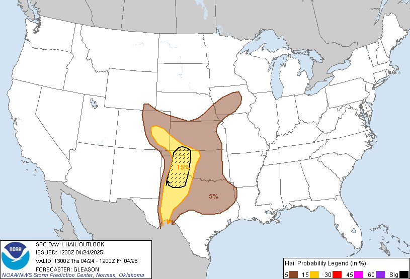
Probability of one inch diameter hail or larger within 25 miles of a point. Hatched Area: 10% or greater probability of two inch diameter hail or larger within 25 miles of a point.
INTELLICAST AND NWS DOPPLER RADAR (INTERACTIVE) 

Information within the outlook, and analysis of various severe storm parameters (i.e. Mid level lapse rates, Craven Brooks values, EHI, STP, SRH, and BULK RICHARDSON SHEAR VALUES) from the 12Z soundings around the moderate risk area, indicate the atmosphere is setting up to become more unstable as we get further into the afternoon. The following is the current Public Severe Weather Outlook:
SPC PWO
http://www.spc.noaa.gov/products/outlook/pwo.html
Areas within the moderate risk area could experience Strong (EF-2 – EF-5) Tornadic activity today. Those within the hatched area would tend to be more susceptible. Based on the combination of the Day 1 Outlook, and the eastward movement today of the forecast parameters within my analysis, SRH is forecast to increase, and albeit cloud cover may reduce instability, kinematic parameters indicate lapse rates could strengthen, as well as the mid and low level jets. Based on effective shear velocities, and the forecast setup, this office, in the interest of utmost safety, this forecast office has determined this situation has the possibility of evolving into a PDS (Particularly Dangerous Situation). Residents under the MODERATE risk area should monitor local NWS statements, local media broadcasts, and monitor NOAA Weather Radio throughout today and tonight. Based on data provided through F5 Data software from the both the NAM-WRF and RAP models, I am not willing to rule out the possibility of strong tornadic activity late this afternoon into tonight in the following outlined area:
I will be checking in every so often throughout the day, to see if watches and/or warnings have been updated and or issued.
T. F. “STORM” WALSH III
GMCS, USCG (ret)
METEOROLOGIST / HURRICANE SPECIALIST
MEMBER WEST CENTRAL FL AMS
CERTIFIED SKYWARN OFFICIAL STORM SPOTTER (advanced)
CoCoRaHS OBSERVER




Merry christmas to all of my great bloggers on here and thank you mr storm for all of your hard work here on christmas day a tornado touch down about 10 miles from my house at 500pm.I am sorry i have not been on here dad has got terminal liver cancer.
Glad you are OK Greg, praying for your Dad, sorry to hear his prognosis.
Thank you originallt that means a lot its been hard but with everybodys prayers we will make it and again thanks everybody.
Echoing LT…Prayers are with you for your Dad Greg. Merry Christmas…God Bless you and all of your family!!
Greg, glad you are ok. I’m truly sorry to hear about your father…I will be praying for him and your family.
Thanks as always Storm–even got you working on Xmas Day!. Hope Dellamom and Greg from Mobile are OK. Haven’t heard from Greg in a long while.
Hey Storm…quick question…do you think the SPC will drop the Moderate Risk down a little further South into CHS? I re-sent your synopsis to friends/family in the SEUS and told them to read it…heed it…and spread it!!
Thanks Storm. I’m passing this on to people in the affected areas. Please stay safe down there!!
Thanks Monty…I guess I hit it again calling for a possible PDS. Merry Christmas…tell folks to stay safe
You pegged it indeed Storm!! Your synopsis is much appreciated as always. It looks like TPA could get hit with this system as well. Stay safe Jedi Master and I hope you and everyone is having a wonderful and safe Christmas!!
Merry Christmas Storm! Thanks for the update
Thanks again Storm. The wind here just started getting strong. Hope everyone stays safe today and tomorrow. Whoop lights just went on and off. looks like that line is headed my way.
You’re welcome, Stef!