
Disclaimer: This site is not affiliated with the National Hurricane Center, Hurricane Hunters, Storm Prediction Center, or National Weather Service. ALL forecasts herein are the result of my analysis, (to which you will see me at times, insert excerpts from various agencies due to the nature of the importance of the information) and I am solely responsible for the content. As ALWAYS, follow the National Hurricane Center, National Weather Service, and your local Emergency Management officials for emergency decisions. In addition, this is strictly a FORECAST OFFICE. I CANNOT make decisions regarding travel plans, etc. My purpose, is to provide you the information, based solely on information I analyze, and the accuracy of the information at hand of the time of analysis, so you may make informed decisions.
(T. F. “Storm” Walsh)
For those who have donated to my site, your help has been greatly appreciated. If you are not aware, donations to my site help pay for subscriptions to sites I use as well as software updates, which provide all the models and information used in my forecasts. To donate, please click the DONATE button to the right side of the page, or on the graphic of the dog. Any help you provide is immensely appreciated!
DONATIONS ACCEPTED AND APPRECIATED


Good day everyone!
I will be out of the office from 27 June through 29 June. I will resume updates upon my return.
Please note! In regard to the severe weather forecasts, I will try to have them back for ENHANCED areas or above, once some of the models I use for analysis come back up. They are still down, and contain information I use to provide a more accurate forecast.
Please use the following links regarding severe weather activity:
SPC HOMEPAGE LINK
https://www.spc.noaa.gov/classic.html
NADOCAST
http://data.nadocast.com/
I will reiterate, my forecasts are based on the available information at the time of analysis, and are only as accurate as the information analyzed and the solutions provided.
For those who follow me on Facebook, I must ask that you please bookmark this wordpress site, send an email to the address at the bottom of the page to be put on the client email list, or visit my site on Facebook. https://www.facebook.com/groups/950628219042775
Due to the amount of weather groups I belong to, and emails I have to send out, I am not able to post to everyone personally. In posting personally, it takes about 1 hour to get my information out to everybody. Thanks for your understanding.
The following is my outlook forecast for the 2024 Atlantic Hurricane Season:
STORM W’s SEASONAL FORECAST
TOTAL NAMED STORMS: 23 – 26
TOTAL HURRICANES : 12 – 15
MAJOR HURRICANES: 6 – 8
AVERAGE HURRICANE SEASON:
TOTAL NAMED STORMS: 14
TOTAL HURRICANES: 7
MAJOR HURRICANES: 3
SEASON TOTALS
NAMED STORMS: 1
HURRICANES: 0
MAJOR HURRICANES: 0
The following are the storm names for the 2024 hurricane season. As each storm is named, they will be colored in red in order to keep track of the used names in the list:
| Alberto | Helene | Oscar |
| Beryl | Isaac | Patty |
| Chris | Joyce | Rafael |
| Debby | Kirk | Sara |
| Ernesto | Leslie | Tony |
| Francine | Milton | Valerie |
| Gordon | Nadine | William |
For those who have followed my over the years, you know as a system approaches the islands, or the U.S. coast, the updates tend to become longer. However the information is critical, and includes links to the NHC watch and warning areas with information regarding hazards affecting land such as wind, storm surge, rainfall, surf, tornadoes, and specific areas along with any changes to the advisory hazards. I also post storm surge maps from SLOSH data software, forecast rainfall, watch and warnings maps, etc. I will also post in general as part of the forecast, animated model maps of the system, current steering layer, etc. In the meantime, I did a little change, and have posted very good hurricane preparedness links to the site. Please click the following link to access this information.
https://stormw.wordpress.com/stormws-toolbox/
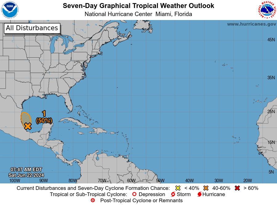
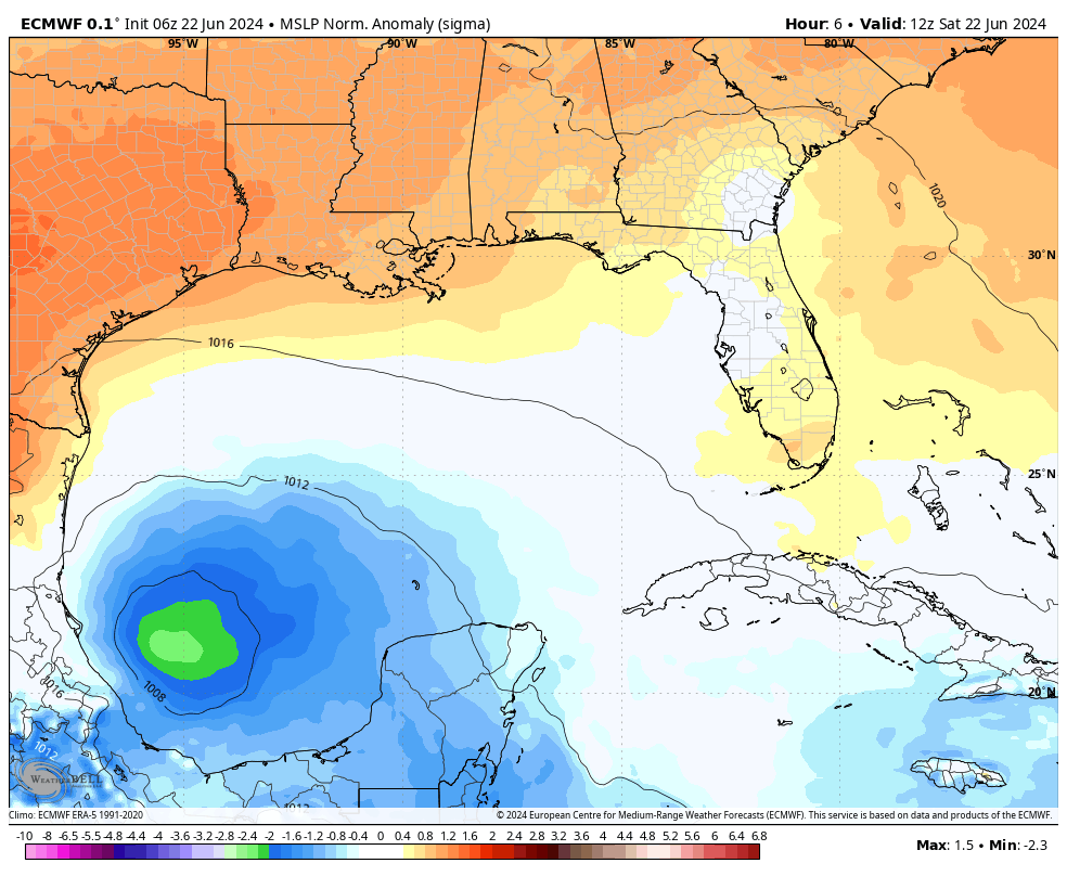
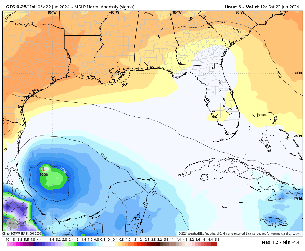
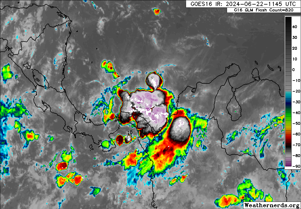
The area located in the Bay of Campeche (BOC) has been designated INVEST 93L. The current probability for tropical cyclone development is MEDIUM (50%). The NHC indicates this may become a Tropical Depression, before crossing the Mexican coast.
NHC GTWO (1) (LINKED)
Based on the 12Z ATCF BTK report, the following was available on INVEST 93L
8:00 AM EDT Sat Jun 22
Location: 20.2°N; 95.2°W
Moving: WNW at 13 mph
Min pressure: 1005 mb / 29.68 in
Max sustained: 30 mph
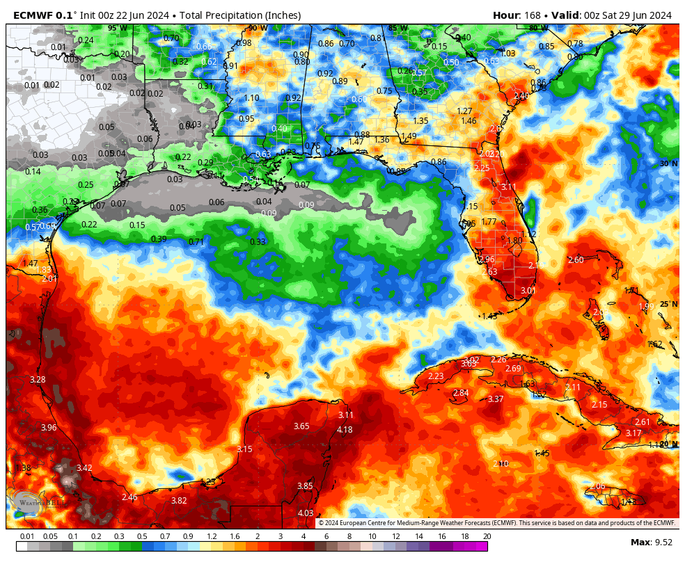
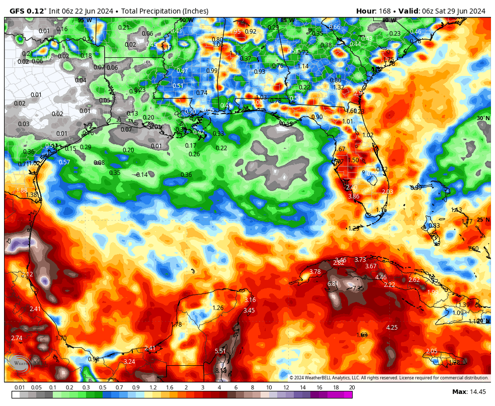
93L is comparable in size to ALBERTO. Based on the large circulation, the NHC has issued the following in the outlook. I highly recommend residents of extreme south Texas remain alert for additional flooding:
Regardless of development, heavy rainfall could cause localized flooding across portions of northeastern Mexico and Deep South Texas through the end of the weekend.
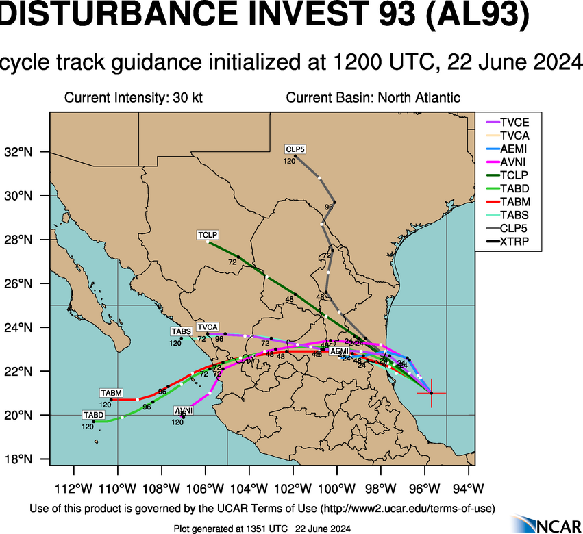
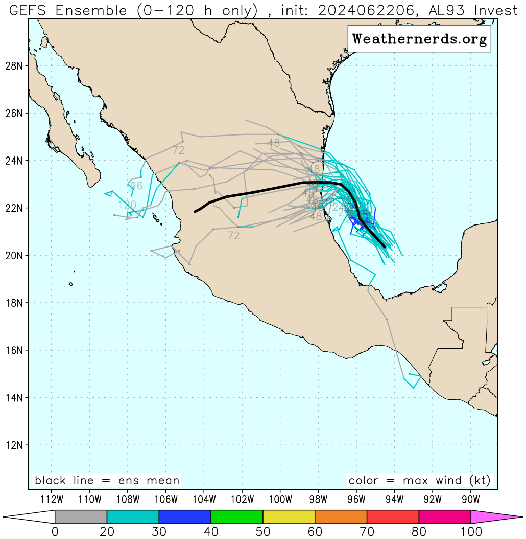
Based on my analysis of current and forecast steering maps, track guidance models indicate 93L should continue on a pretty much WNW to NW track during the next 48 hours and come ashore in Mexico. Guidance has just been initiated and track forecast could change slightly upon the next run.
INVEST 93L SATELLITE LOOP IMAGERY (IR, VIS, WATER VAPOR)
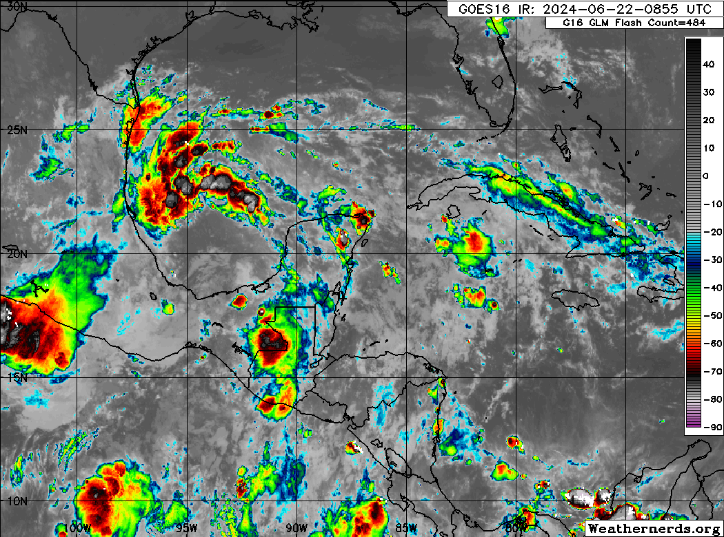
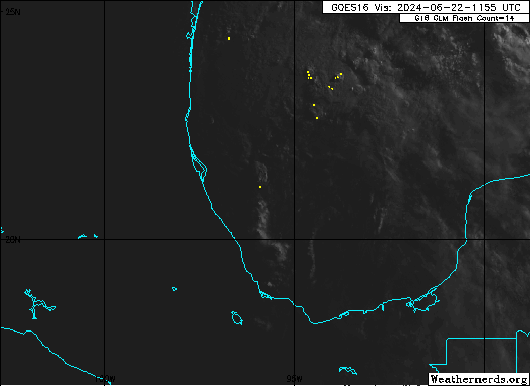
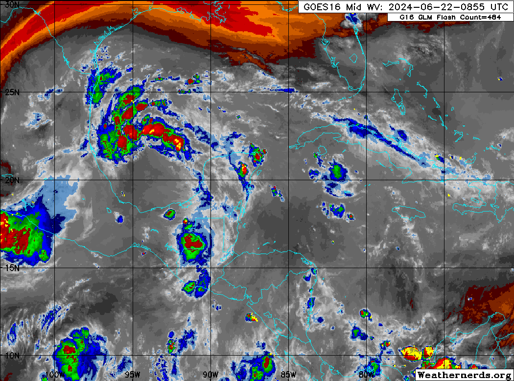
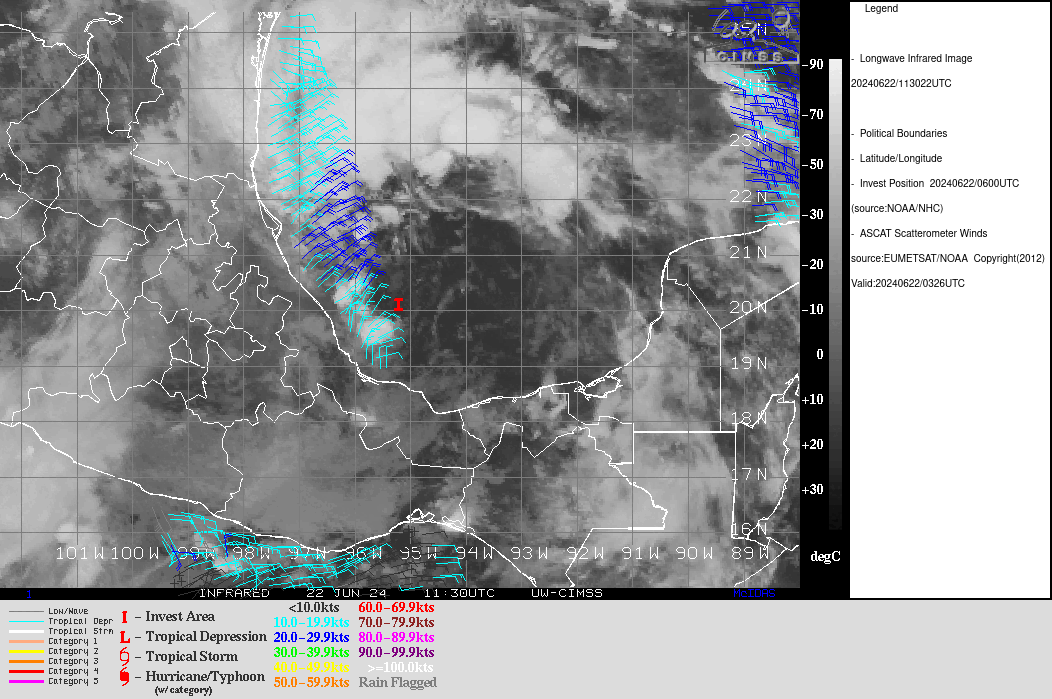
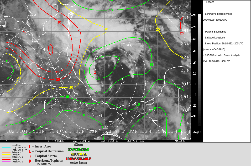
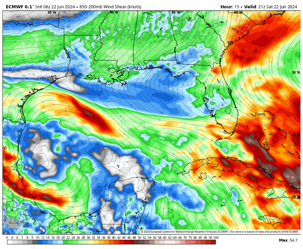
While the early morning ASCAT pass did not indicate a circulation, recent close analysis of visible satellite loop imagery indicates the center of circulation may be becoming better defined, with convection beginning to build on the western edge. We’ll have to see if this continues. Analysis of wind shear from CIMSS did indicated a building radial shear pattern.
CIMSS 93L ASCAT MAP
CIMSS 93L WIND SHEAR
Based on my analysis of current and forecast steering maps, I agree with the current track guidance and 93L should make landfall in about 48 hours.
12Z RAL ATCF GUIDANCE
ECMWF EPS AND GEFS ENSEMBLE GUIDANCE
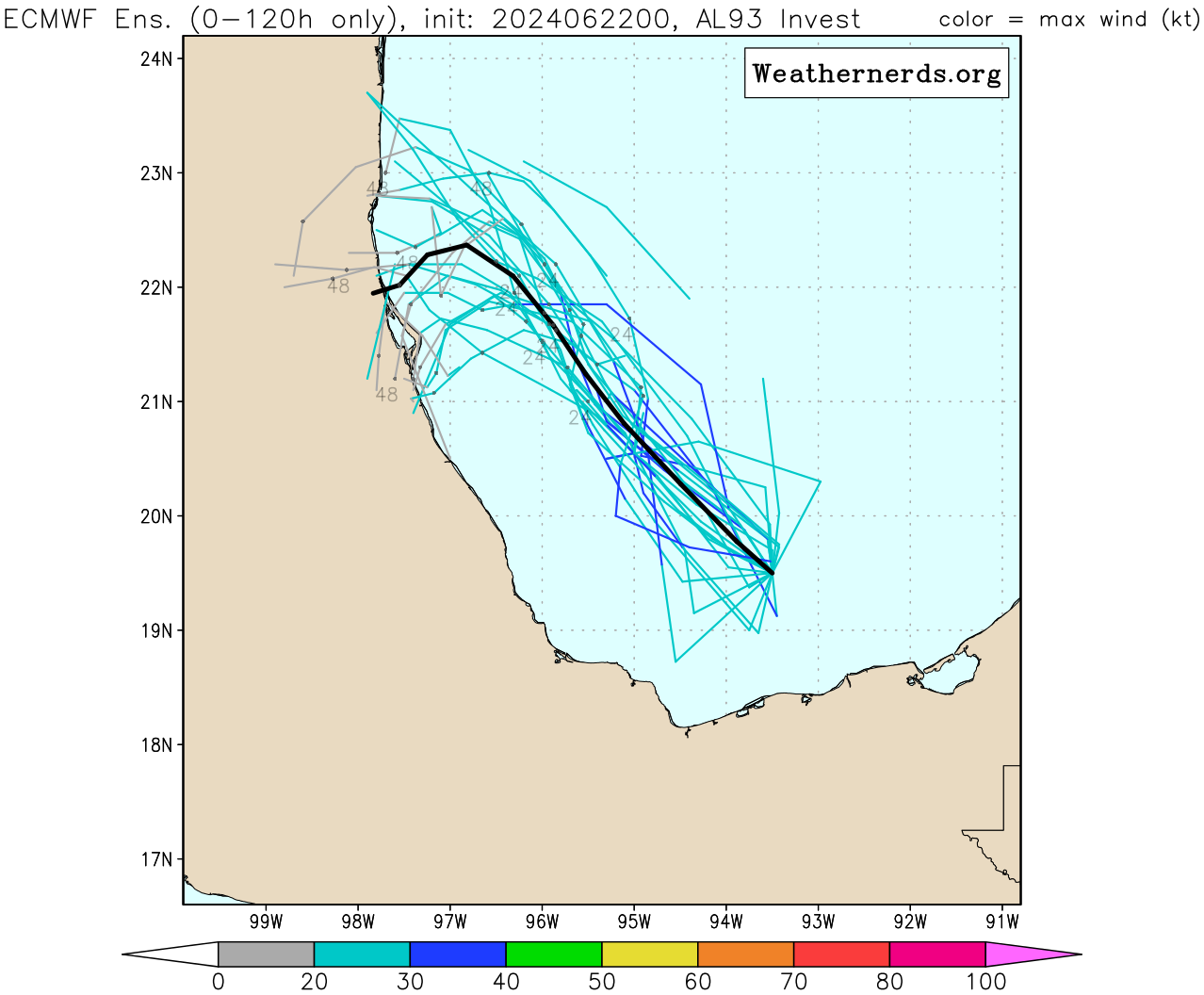
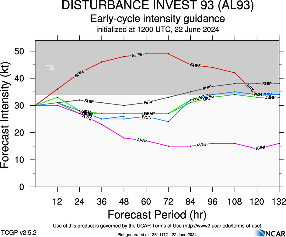
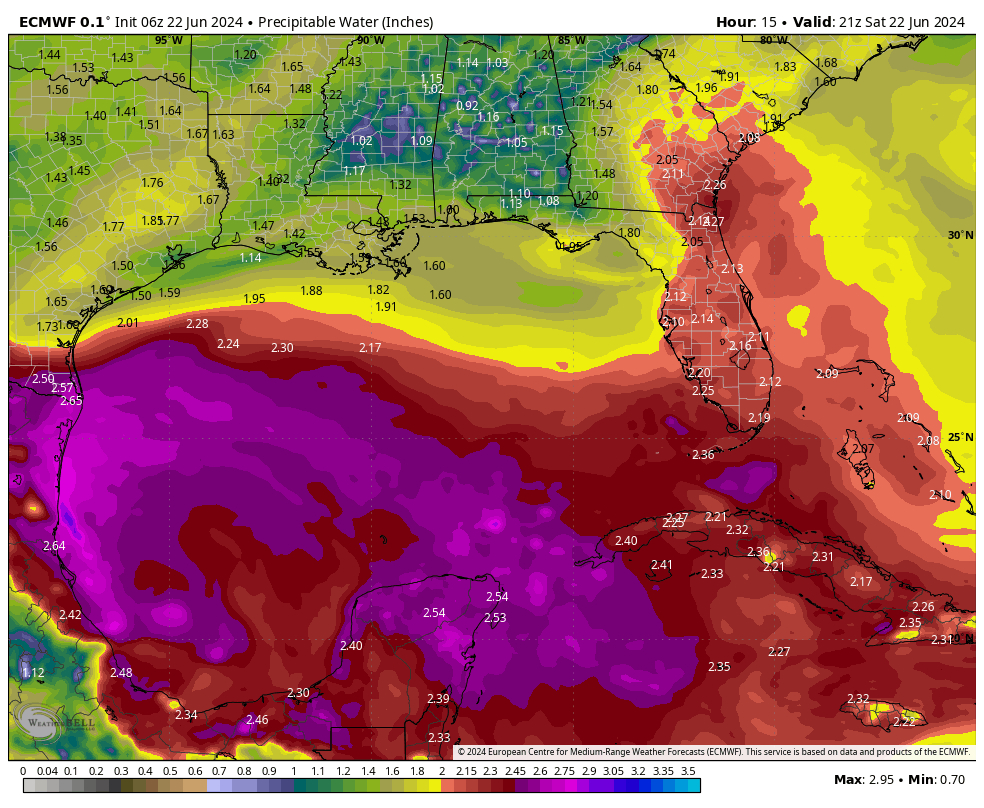
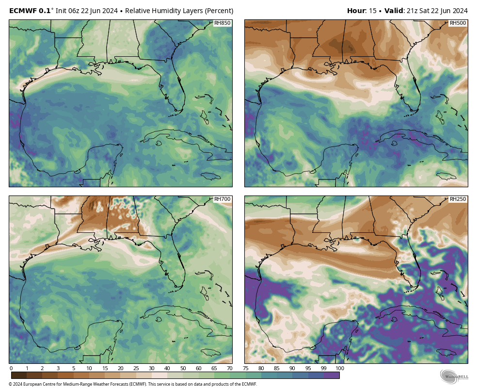
Based on current and forecast parameters, Both the ECMWF and GFS currently indicate some favorable conditions, with these conditions become a little more favorable during the next 36 to 48 hours in the forecast period, regarding wind shear, PWAT and relative humidity values from 850mb – 500mb. Based on this, I believe a depression is probable, however given the nature of the large area as with ALBERTO, this may be slow to occur, and the system only has a short window to accomplish this (36 – 48 hours, depending on forward speed). Current intensity guidance does not really strengthen this system however.
12Z INTENSITY GUIDANCE
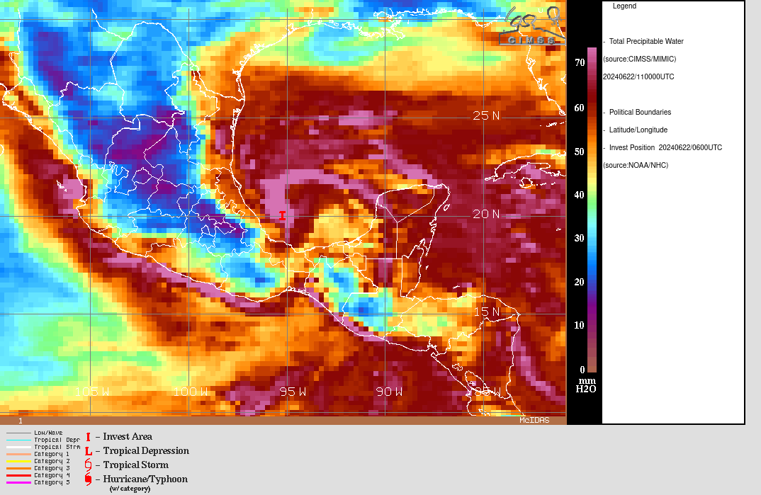
CIMSS CURRENT PWAT
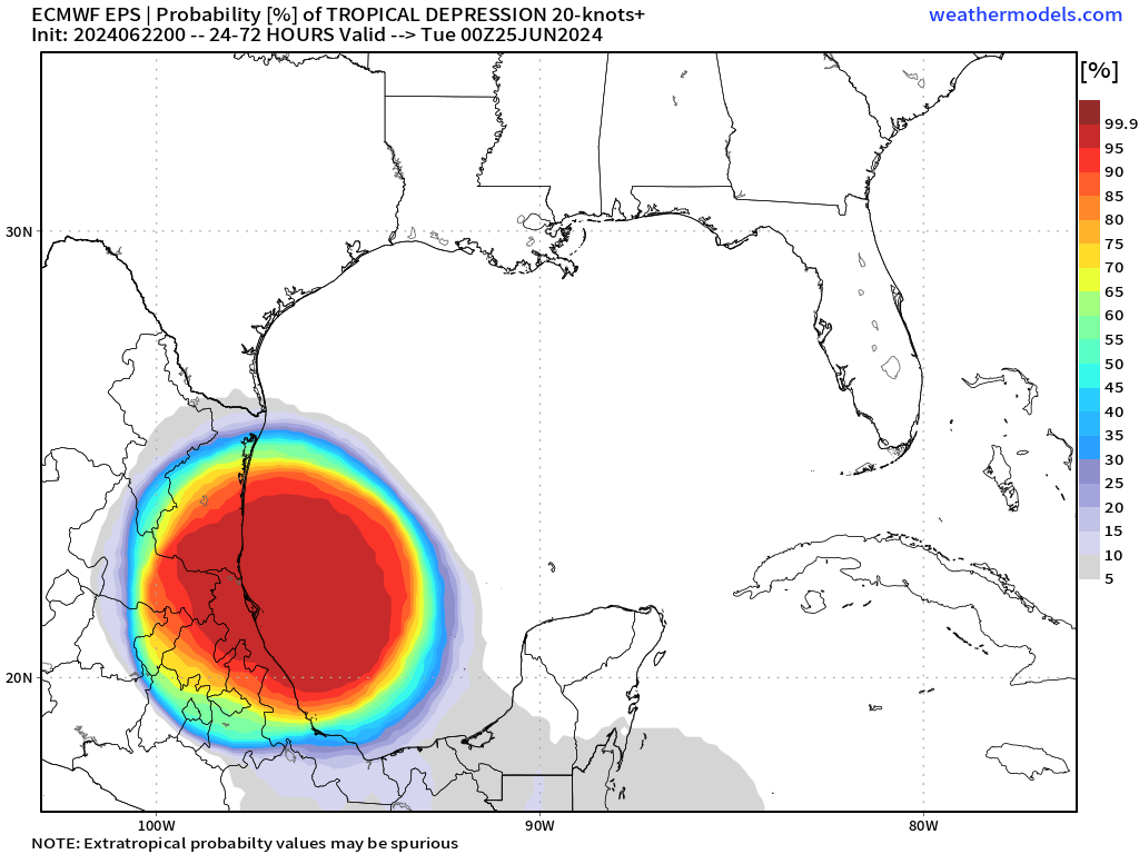
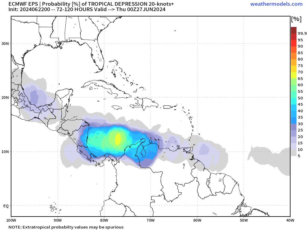
ECMWF EPS T.D. PROBABILITY
ECMWF AND GFS FORECAST SURFACE MAPS
ECMWF WIND SHEAR, PWAT, AND RH FORECAST
7 DAY RAINFALL FORECAST
I will continue to monitor INVEST 93L for any significant changes.
Elsewhere, I am going to monitor the area approaching Central America, as the ECMWF EPS Cyclone Formation Probability forecast currently indicates a 60 – 65% likelihood of T.D. development within the next 3 -5 days.
Elsewhere, Tropical Storm formation is not expected during the next 7 days.
The following NWS Watch / Warning map will provide local NWS information for your area. Click the image, then once it refreshes, click on your area of interest to view any special weather statements, hazards or advisories for your area.
NWS WATCH / WARNING DISPLAY (LINKED…CLICK MAP, THEN YOUR AREA)

NWS DOPPLER RADAR LOOP (LINKED, CLICK RADAR MAP)
RAP RADAR (CLICK IMAGE THEN GO TO LOOP DURATION AND PICK LENGTH OF LOOP, THEN CLICK RADAR SITE)
CARIBBEAN RADAR (CLICK IMAGE TO ACCESS ANIMATION)

You may direct any questions by contacting me personally, ANYTIME, at: twalsh22000@yahoo.com
Have a blessed day!
T. F. “STORM” WALSH III
GMCS, USCG (ret)
METEOROLOGIST / HURRICANE SPECIALIST /SEVERE WEATHER SPECIALIST


